
Drone Survey & Digital Mapping Services in Sydney
Precision from Above. Insight from Every Angle.
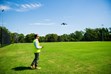
At Astra Spatial, we deliver drone survey and digital mapping services that give designers, engineers, and builders a complete view of their Sydney projects before work begins. Our licensed surveyors combine UAV photogrammetry with ground control to produce accurate terrain models, contours, and orthomosaic imagery suitable for planning, volume calculations, and progress tracking.
Why Drone Surveys and Digital Mapping Matter in Sydney
Drone surveys capture detailed aerial data faster and more safely than traditional methods, especially on large or hard-to-access Sydney sites. High-resolution imagery and 3D models allow you to analyse topography, design earthworks accurately and monitor construction progress with confidence.
A certified drone survey for the Sydney project provides precise spatial data for:
- Site planning and feasibility studies
- Cut-and-fill volume calculations
- Environmental and erosion monitoring
- As-built and progress verification
- Infrastructure and asset documentation
Our team operates under CASA ReOC licensing and complies with all airspace and safety regulations in NSW.
Our Sydney Drone Survey & Digital Mapping Process
1 | Pre-Flight Planning & Permissions
We assess site location, terrain, and airspace requirements, lodging necessary flight approvals under CASA and local council guidelines.
2 | Ground Control
Survey-grade ground control points are established to tie aerial imagery to accurate map datums (AHD & MGA coordinates).
3 | Aerial Data Capture
Our UAVs capture overlapping imagery and LiDAR data using automated flight paths to ensure uniform coverage and detail.
4 | Data Processing & 3D Model Generation
Captured images are processed using photogrammetry software to create digital surface models, orthophotos, and 3D point clouds.
5 | Quality Review & Deliverables
All outputs are checked against control data for accuracy and delivered in CAD, GIS, and PDF formats, ready for design integration.
What We Offer
Aerial Survey & Mapping
- Drone survey in Sydney for residential, commercial, and infrastructure sites
- Drone survey in Sydney for construction progress and civil projects
Digital Mapping & 3D Modelling
- Digital mapping in Sydney for engineering and planning applications
- 3D mapping in Sydney, NSW, for architectural and design projects
- Digital terrain mapping in Sydney for larger sites, earthworks, and infrastructure
Aerial Analysis & Site Monitoring
- Aerial mapping for Sydney development sites
- Drone mapping in Sydney for infrastructure and construction corridors
- Aerial site scanning for Sydney metropolitan construction projects
Specialised UAV Applications
- UAV drone survey for Sydney site capture for pre-design analysis
- 3D drone mapping in Sydney for asset planning and documentation
- Aerial site scanning in Sydney for volume and as-built verification
Where We Work
We service Sydney and wider NSW, including:
- New South Wales (Sydney Metro): Sydney CBD - Parramatta - Hornsby - Inner West - North Sydney - Hills District
- Regional NSW: Key centres and surrounding regional NSW towns (subject to project scope)
Why Choose Astra Spatial
- Licensed surveyors and CASA-certified drone operators in NSW
- High-accuracy photogrammetry for survey-grade results
- Rapid turnaround and safe, efficient data capture
- Integration with CAD, GIS, and design platforms
- Proven experience across construction, subdivision, and infrastructure projects
Our drone surveyors deliver accurate, geo-referenced aerial data that helps clients design, build, and maintain projects with confidence and compliance.
Frequently Asked Questions
Are you licensed to operate drones commercially?
Yes. Astra Spatial holds a CASA Remote Operator’s Certificate (ReOC), and our pilots are licensed under the Civil Aviation Safety Regulations.
What accuracy can I expect from a drone survey?
Our surveys achieve centimetre-level accuracy comparable to traditional methods.
Can you work in restricted airspace?
Yes—subject to CASA and local council approvals. We handle all flight permissions as part of our pre-planning process.
What deliverables do you provide?
Orthomosaic maps, digital terrain models (DTMs), 3D point clouds, and contour plans in AutoCAD (DWG), GIS, and PDF formats.
Do you offer progress or volume tracking?
Yes. We regularly capture drone imagery for earthworks volumes, construction progress and as-built verifications.