
Preservation of Survey Infrastructure (POSI) Services in Sydney
Protecting the Foundations of Every Survey
At Astra Spatial, we provide Preservation of Survey Infrastructure (POSI) services in Sydney that safeguard the accuracy and integrity of Australia’s cadastral and geodetic networks. Our licensed cadastral surveyors carry out POSI surveys to re-establish, record, and report on permanent survey marks (PSMs) that underpin property boundaries, development projects, and public infrastructure across Sydney and New South Wales.
Why Preservation of Survey Infrastructure Matters in Sydney
Every property boundary and infrastructure project relies on stable, traceable reference points. When survey marks are disturbed, destroyed, or relocated, cadastral accuracy and future surveys are compromised.
A certified POSI survey in Sydney ensures that damaged or removed control marks are properly reinstated, protecting the integrity of the wider surveying framework. Astra Spatial’s POSI services meet all legislative requirements under the Surveying and Spatial Information Regulation 2024, ensuring full compliance for surveyors, developers, and councils across NSW.
Our Sydney POSI Survey Process
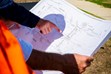
Site Inspection & Control Identification
We locate and identify existing survey marks within or near the project area, referencing cadastral records and government control databases.
Assessment & Condition Reporting
Each mark’s condition, stability, and accessibility are recorded with photographs and coordinate data.
Re-Establishment or Preservation Work
If marks are disturbed or destroyed, replacement PSMs are installed and surveyed to the official datum using total-station measurements.
Data Processing & Validation
Re-established marks are verified against state survey control networks and adjusted within required tolerances.
Reporting & Lodgement
All results, coordinates, and metadata are compiled into a certified POSI report for submission to the relevant land information authority.
What We Offer
POSI & Control Mark Preservation
- POSI survey in Sydney for construction, subdivision, and infrastructure projects
- POSI survey in regional NSW to preserve cadastral integrity
Survey Infrastructure Restoration
- Survey infrastructure restoration in the Sydney region
- Re-marking and protection of historic cadastral control points
Control Mark Re-Establishment
- Control mark preservation in Greater Sydney and regional NSW
- Control mark re-establishment surveys for council and private projects
- Validation and reporting to state control standards
Cadastral Control & Compliance
- Cadastral control survey preservation in Sydney and regional NSW
- Integration with subdivision and infrastructure survey workflows
- Compliance with NSW Spatial Services protocols
Where We Work
We service Sydney and regional NSW, including:
- New South Wales (Metro): Sydney CBD - North Sydney - Parramatta - Inner West - Hornsby - Hills District
- Regional NSW: Griffith - Wagga Wagga - Riverina region towns
Why Choose Astra Spatial
- Licensed cadastral surveyors in NSW
- Experienced in POSI reporting and cadastral infrastructure restoration
- Compliance with Survey and Spatial Information Regulations 2024
- Total-station accuracy for precise control mark reinstatement
- Fast turnaround and transparent communication
Our team combines technical expertise and regulatory understanding, ensuring every survey mark is preserved, reinstated, and certified to the highest professional standard.
Frequently Asked Questions
What is a POSI survey?
A POSI (Preservation of Survey Infrastructure) survey records, reinstates, and certifies permanent survey marks disturbed by development or construction activities.
When do I need a POSI survey?
When construction, excavation, or subdivision work may affect existing survey marks or control points. It is a regulatory requirement under state surveying legislation.
Who requires a POSI report?
Developers, contractors, and surveyors who work near or alter permanent survey marks must submit certified POSI reports to the Surveyor-General or relevant authority.
How accurate is the survey?
POSI surveys are conducted using calibrated robotic total stations, ensuring millimetre-level accuracy referenced to the state geodetic network.
Can Astra Spatial handle lodgement and compliance?
Yes. We prepare and lodge POSI documentation with NSW Spatial Services, ensuring full compliance and traceable reporting.