
Utility Location & Underground Services Surveys in Sydney
Locate Before You Build. Protect What’s Underground.
At Astra Spatial, we provide professional utility location and underground services surveys to help builders, developers, and civil contractors avoid costly damage and delays in Sydney.
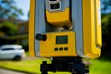
Our surveyors use Ground Penetrating Radar (GPR), electromagnetic detection, and survey-grade positioning equipment to locate, map and record underground utilities before excavation or construction.
Why Utility Location Surveys Matter in Sydney
Before construction begins, it’s critical to know exactly what’s underground. Gas, electrical, telecommunications, and water services can all pose serious safety and cost risks if struck during excavation.
A certified utility locating Sydney survey ensures you know the exact position and depth of existing services — protecting workers, infrastructure, and project budgets.
Our survey data is fully geo-referenced, compatible with engineering and design software, and formatted for integration into construction workflows.
Astra Spatial provides accurate subsurface mapping for residential developments, commercial projects, infrastructure works, and subdivisions throughout Sydney and NSW.
Our Sydney Utility Location Survey Process
1 | Preliminary Review & Before You Dig Australia (BYDA) Checks
We gather all available underground service plans and existing utility records to understand the known site infrastructure.
2 | On-Site Detection & Marking
Using GPR and electromagnetic detection, our technicians trace and mark underground pipes, cables, and conduits in real time.
3 | Surveying & Data Capture
Our surveyors record detected utility locations using total station methods for precise spatial reference.
4 | Mapping & Digital Plan Production
All detected utilities are mapped in CAD and GIS formats, colour-coded by service type (water, electrical, comms, gas, sewer, stormwater).
5 | Reporting & Delivery
We deliver a certified utility location report and digital plans ready for inclusion in design and construction documentation.
What We Offer
Comprehensive Utility Locating
- Utility location in Sydney for residential, commercial, and civil works
- Utility location in NSW for regional and infrastructure projects
Underground Services Surveys
- Underground services survey in Sydney for new developments and upgrades
- Utility location in NSW for rural and regional properties
Advanced GPR & Mapping Services
- GPR utility locate in Sydney for urban construction sites
- Utility detection survey in NSW for civil design and pre-construction
- Services locating survey in Sydney commercial and industrial buildings
Digital Deliverables & CAD Integration
- AutoCAD and PDF deliverables for site coordination
- GIS shapefiles and contour overlays for larger infrastructure sites
- Integration with as-built and construction set-out plans
Where We Work
We service Sydney and regional NSW, with additional coverage in Adelaide:
- New South Wales: Sydney CBD - Inner West - Parramatta - Hornsby - Hills District - North Sydney
- Regional NSW: Griffith - Wagga Wagga - Riverina region towns
- South Australia: Adelaide Hills - Burnside - Unley - Walkerville - Holdfast Bay - Prospect
Why Choose Astra Spatial
- Licensed surveyors and accredited underground utility locators
- GPR and electromagnetic detection for non-invasive service mapping
- Robotic total station accuracy for precise depth and position
- Digital deliverables compatible with design and construction software
- Fast turnaround with transparent reporting
Our team combines field precision, advanced technology, and safety-first methodology, ensuring every excavation or build begins with reliable underground data.
Frequently Asked Questions
What is a utility location survey?
A utility location survey identifies and maps underground pipes, cables, and other services to prevent damage during excavation or construction.
When should I book one?
Before any digging, trenching, or foundation work begins. It’s essential for new builds, renovations, civil projects, and infrastructure upgrades.
What technology do you use?
We use Ground Penetrating Radar (GPR), electromagnetic detection, and positioning technology to accurately detect and record services.
Do you provide depth information?
Yes — depth estimations are provided for detected services and clearly shown on deliverable plans.
Can you integrate with design drawings?
Absolutely. All plans can be delivered in AutoCAD or GIS formats for seamless coordination with engineering or architectural workflows.