
Land Division Survey in Adelaide: Requirements, Costs and Key Steps
A land division survey in Adelaide is what turns one block into two or more legal lots that can be sold, built on, or developed separately. It ties directly into planning rules, title creation, boundary definition, and council approval. If the early survey work is wrong, the whole project slows down fast.
Most people don’t start by searching for a survey. They start with an idea. Split the backyard. Build a second dwelling. Create a duplex site. This is the process that makes that happen.
What is a Land Division Survey in Adelaide?
A land division survey in Adelaide defines how land is divided into separate titles.
It starts with a boundary survey. Before new lots can be created, the legal boundaries of the existing property need to be confirmed properly.
From there, the survey defines the proposed lot layout, access, dimensions, easements, and any title changes required for approval and registration.
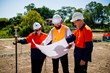
In South Australia, cadastral and boundary work is completed by a Licensed Surveyor.
When You Need a Land Division Survey
Most residential projects in Adelaide fall under land division rather than subdivision.
You might need a land division survey if you’re:
- Splitting a residential block into two lots
- Building a duplex or pair of dwellings
- Creating a new Torrens Title allotment
- Adjusting boundaries between neighbouring properties
A common example is a homeowner with an 800 square metre block in Adelaide’s western suburbs wanting to create a second lot at the rear.
At first glance, it looks simple. Then the real constraints show up. Minimum frontage. Driveway width. Sewer locations. Open space requirements. That’s usually when people realise they need proper advice before spending money on plans that may not get approved.
At that point, most property owners speak with a land division surveyor Adelaide clients already trust for residential work.
Requirements for a Land Division Survey in Adelaide
There are a few things that need to line up before approval happens.
Planning Approval
Every land division needs to comply with the Planning and Design Code.
That includes:
- Minimum lot size
- Frontage requirements
- Vehicle access
- Zoning controls
- Easements and service access
We’ve seen proposals rejected because the frontage missed council requirements by less than 200 millimetres. Small details matter.
For more detail on planning approvals, refer to the SA Planning Portal.
Boundary Survey
This is where the boundary survey becomes important.
We regularly see fences sitting away from the true legal boundary. Sometimes by only a few centimetres. Sometimes much more.
That becomes a problem when the proposed land division is already close to minimum size or frontage limits.
Services and Easements
Stormwater, sewer, water, power, and NBN all need to be checked.
One issue we see often is existing sewer infrastructure running through the middle of a proposed allotment. That can trigger redesigns, easements, or extra civil works.
This is also where utility location and underground services surveys can help reduce risk before construction starts.
Final Survey and Lodgement
Once approval conditions are met, the final land division survey is completed.
The new allotments are surveyed, plans are prepared, and the documentation is lodged with Land Services SA so new titles can be issued.
Key Steps in a Land Division Survey in Adelaide
The process is usually consistent, even if the sites themselves are very different.
1. Initial Feasibility Review
This is the first conversation.
Can the block actually support the outcome you want?
We’ve seen clients spend thousands on architectural concepts before finding out the site didn’t meet frontage or access requirements. A feasibility review early on avoids that.
2. Boundary Survey
The legal boundaries are confirmed and measured.
This forms the base for the entire project.
3. Detail Survey
A detail survey captures the physical features of the site.
That includes buildings, retaining walls, fences, trees, levels, and visible services.
Designers rely on this information heavily. If the data is wrong, the design usually ends up wrong too.
4. Planning Submission
The proposed land division is prepared and submitted for planning approval.
Changes during this stage are common. Council may require adjustments to access, private open space, or lot dimensions before approval is granted.
5. Civil Works and Services
Some projects require additional works before titles can be created.
That could include:
- Driveways
- Stormwater upgrades
- Sewer connections
- Service relocations
This stage often works alongside construction set out surveys.
6. Final Survey and Title Registration
The final survey marks the new allotments and prepares the plan for registration.
Once lodged and approved, separate titles are created.
What Does a Land Division Survey Cost in Adelaide?
Costs vary depending on the site and complexity.
More complicated projects cost more. Steep sites, irregular shapes, drainage issues, easements, or difficult service connections all increase time and survey requirements.
We recently looked at two sites with similar block sizes. One had simple access and existing infrastructure nearby. The other needed stormwater redesign and additional service coordination. The second project ended up nearly double the survey cost.
For larger projects or master planned communities, the terminology generally shifts back toward subdivision rather than residential land division.
What Slows Land Division Projects Down
Most delays happen because something wasn’t checked early enough.
Boundary issues are common. If the legal boundary is wrong, the proposed lot layout may no longer comply.
Service issues are another major one. We’ve seen projects paused while sewer infrastructure was redesigned because nobody confirmed the existing asset locations upfront.
Planning compliance also catches people out. A design can look fine visually but still fail because of frontage, setbacks, or access widths.
The smoother projects usually follow the same pattern. Early survey work is done properly, the planning rules are understood upfront, and the design reflects the real conditions on site.
Why the Right Survey Team Matters
Land division projects move through several stages.
If different consultants are handling disconnected parts of the process, information gets missed. That’s usually where delays, redesigns, and approval problems start.
Working with a team that manages subdivision and land development surveys, boundary work, detail surveys, and final lodgement keeps the process much cleaner.
It also means you get clearer advice from the start instead of conflicting information halfway through the project.
Moving Forward with a Land Division Survey in Adelaide
If you’re considering a land division survey in Adelaide, the first step is understanding what your site can realistically support.
A quick review early on can identify potential issues before you commit to design costs or planning applications.
Astra Spatial works across Adelaide and surrounding regions on residential land division projects, boundary surveys, detail surveys, and development support. Whether you’re planning a simple backyard split or a more involved development project, we can help guide the process from start to finish.
If you’ve got a site in mind, reach out via the contact page and we’ll go through your options with you.